Image Credit: Flystock/Shutterstock.com
Nondestructive metrology techniques are beneficial when it comes to analyzing building materials, particularly concrete and pavement. Metrology can also be invaluable when it comes to assessing potholes and the overall status of roadways.
By performing metrological tests, these techniques offer the ability to inspect large structures and infrastructure. That said, gaining the precise metrology measurements is a challenging task in these areas due to the heterogeneous nature of both building materials and road surfaces. Below are a few modern approaches to visualizing metrology information in building material.
Optical Metrology
Optical 3D metrology can be used to characterize building material qualities. Capturing thousands of frames per second, optical systems use stereo cameras to assess both singular points and total surfaces.
The system is particularly valuable when it comes to metrological analysis during mechanical testing, when it can gather 3D data on displacements and strains within a material. This approach saves time, supplies useful data and can reveal optimal applications for materials.
The fact that it offers both point and surface examinations makes an optical metrology system especially useful. For instance, if technicians want to examine the fiber-dominant mechanical qualities and the matrix-dominant qualities of a composite, total-surface data is necessary and can be easily acquired by an optical system. Optical metrology can even provide data on unforeseen effects of mechanical testing.
Visualization Using Ultrasound
Ultrasonic NDT techniques are often used to supply data on the microstructure of building materials.
Ultrasonic tomography (UT) is an increasingly popular technique that is often used for quality control during construction and rehabilitation works. The method involves the use of shear waves to produce 3D tomographic imagery of concrete building material, which allows for the diagnosis of defects in concrete structures.
UT can be used to ascertain the integrity of material within a structure, as it is capable of detecting cavities, exfoliations and cracks. IT can also gauge the thickness of the test object. UT can be used for the internal analysis of structures made from concrete and various stone types.
The technique involves the application of a pulse-echo to one side to the test object. Through the use of receiving transducers, a UT device can detect signal propagation and the system compares that information to calibration data for the material being tested.
UT is an excellent approach to generating a three-dimensional image of internal flaws that may occur in a test subject.
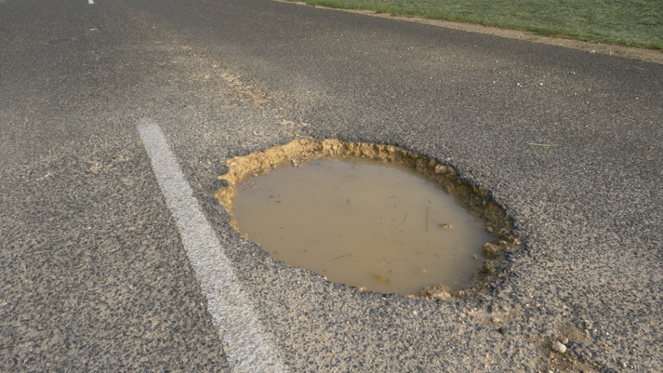
Pothole Visualization
Accurately analyzing potholes is essential for proper pavement construction, maintenance and rehabilitation.
As pavement ages, potholes are essential evidence that can point to structural flaws of a roadway.
Unfortunately, the identification of cracks and potholes is typically carried out manually, which can be labor- and time-consuming. Three-dimensional visualization has been effectively used in this area, but the technology is still very much in development.
Pothole visualization techniques can be categorized into three different groups: 3D laser scanner techniques, stereo vision techniques, and visualization using the Microsoft Kinect sensor.
Laser scanning systems are capable of identifying potholes in real-time. However, the price of laser scanning gear is still prohibitive at the vehicle-level.
One 3D laser-scanner system used in a study employed reflected laser pulses to generate precise digital models. In the study, specific 3D cloud points of potholes were captured and extracted to spotlight particular stress features. The study results showed the intensity and coverage of stress-related features such as potholes can be precisely and automatically quantified to determine the amount of necessary fill material.
With a stereovision system, a pair of connected digital cameras are utilized to scan a surface. The initial analysis with the system is the investigation of 2D pictures from each camera to recognize and categorize any cracks. The outcomes from the image analyses are then combined to ensure greater consistency. The stereo images are then used to create a 3D surface image. The extraction of 3D qualities from pairs of 2D images requires calibration of the cameras, distortion correction, stereo points matching and 3D reconstruction.
The stereovision approach includes a high processing demand to model a surface, making it a challenge to achieve in real-time. Both cameras need to be precisely aligned because the misalignment can significantly impact the quality of outcomes and amplify issues caused by the vibrations of the vehicle carrying it.
In a 2018 study, a UK-Pakistan research team used the commercially available, low-cost Kinect gaming sensor to gather pothole images and determine the approximate volumes of each pothole. Using the infrared Kinect sensor, researchers amassed pothole image data from concrete and asphalt roadways. Digital meshes were produced for visualization, the study team compared the area of the pothole to its depth, and approximate volumes were calculated.
While the Kinect sensor approach is cost-effective compared to scientific or industrial imaging systems, the use of this technology is still a nascent technology that is not quite ready for widespread use.
References and Further Reading
Disclaimer: The views expressed here are those of the author expressed in their private capacity and do not necessarily represent the views of AZoM.com Limited T/A AZoNetwork the owner and operator of this website. This disclaimer forms part of the Terms and conditions of use of this website.